Monday, March 12, 2012

Feb. 16th The Grand Lucayan Waterway

The Grand Lucayan Waterway is a man made canal that cuts across Grand Bahama Island a few short miles from Port Lucaya. Once through the waterway we would be on the Sea of Abaco and only two days from our destination of Marsh Harbor. The waterway is shallow and would require our timing our exit at Dover sound to a rising tide. The waterway was built with high hopes of  developing this area of Grand Bahama Island.  Owners would have the best of both worlds as they would have access to The Sea of Abaco and the Atlantic. Unfortunately it never really got off the ground. There was not enough money to keep it dredged along with other financial difficulties. We passed few homes and many many more that were partially built and abandoned. There were also many lots for sale.  Tom and I thought the area held much promise. There were many indentations cut out along the waterway which meant that the homes could have their own dock built.  The waterway is only about 7 miles long.  It would be a short ride or should I say should have been. When we were near Dover Sound, our exit, Toms tide calculations indicated we needed to wait a couple of hours for the rising tide. We anchored in one of the indented areas to relax and wait.  We decided to take the kayaks out and explore the exit to familiarize ourselves with any tricky spots. We enjoyed the current as it took us swiftly toward Dover Sound. Not so much fun was trying to get back to the boat. This is when we realized we had missed the rising tide and were fighting the tide as it was going out!  At one point we were paddling as hard as we could and not moving forward and if you stopped for a second to regroup you lost a kayaks length in distance that you had worked so hard to get.  For a few minutes I seriously began to think my arms would not hold out long enough to make it back to the boat. Once back on the boat we looked at each other and remarked, "not the smartest thing we have ever done". We ended up sitting around until 4:30 pm so that we had enough water to get through to the Sea of Abaco. We have a four foot draft and there were a couple of four foot two spots that we coasted through while holding our breath, but we did fine. Because of the time delay we were faced with a new dilemma. We could only make it to Mangrove Cay(pronounced key) by dark and we really needed to get to Great Sail Cay Why? Two more good days of weather were predicted before high winds blew in and I had a flight home booked for Sunday morning from Marsh Harbor.  I know you are not supporsed to have a schedule when traveling by boat because of the weather but I was not going to miss my Grandsons first birthday party. As frustrating as the tide problem was we were glad we traveled through the Waterway.  It was really interesting.
                                                 The Lucayan Waterway was narrow

                                      You must stay at center because of the rocks on both sides

                              We never met a boat coming the other way - thankfully

Sunday, March 11, 2012

Wed. Feb. 15th - Checking in at Lucaya

We arrived in Port Lucaya at 5pm. The dockmaster at the harbor told  us we could stay at the fuel dock while checking in. We would then move to an anchorage.  Checking in is a two step process. You meet with immigration, show them your forms and fill out more forms. Then you meet with a customs agent.  The meeting with immigration only lasted a few minutes. When finished the gal told us to go back to the boat and wait. The immigration agent would come to us. It was now getting dark and we were still waiting. Tom approached the dockmaster and explained what we were told.  He called on the radio and told us we had to go back up to the office, that we were given the wrong information.  Now at the office, the agent is outside finishing a cigarette. He holds up a finger to tell us one minute. Finding out that nothing is done quickly in the Bahamas our minute was nearly 10.  It is now dark.  It only took about five minutes to complete the paperwork. When finished the agent told us we owed him $30.00. When I asked what the fee was for he said overtime. It's past 5pm! Tom politely indicated that the sign said that agents are on call at all times. The answer was, yes but after 5pm we charge overtime. All I had were $20.00 dollar bills. When I handed him forty dollars he indicated that they had no change. I responded with we just paid the $300.00 entry fee so the gal in the back should have change. She responded with a no, it is all locked up. Now frustrated all were quiet. Tom calmly said to the agent, it is dark out and we cannot safely anchor out. You keep the extra ten and let us stay on the gas dock until morning. The agent said No problem man, just be gone by 8am. We complied.  Once we hooked up to electricity I wondered around in the shops that were adjacent to the marina.  We were gone by 7am, headed for the Lucaya canal and Great Sail Key.
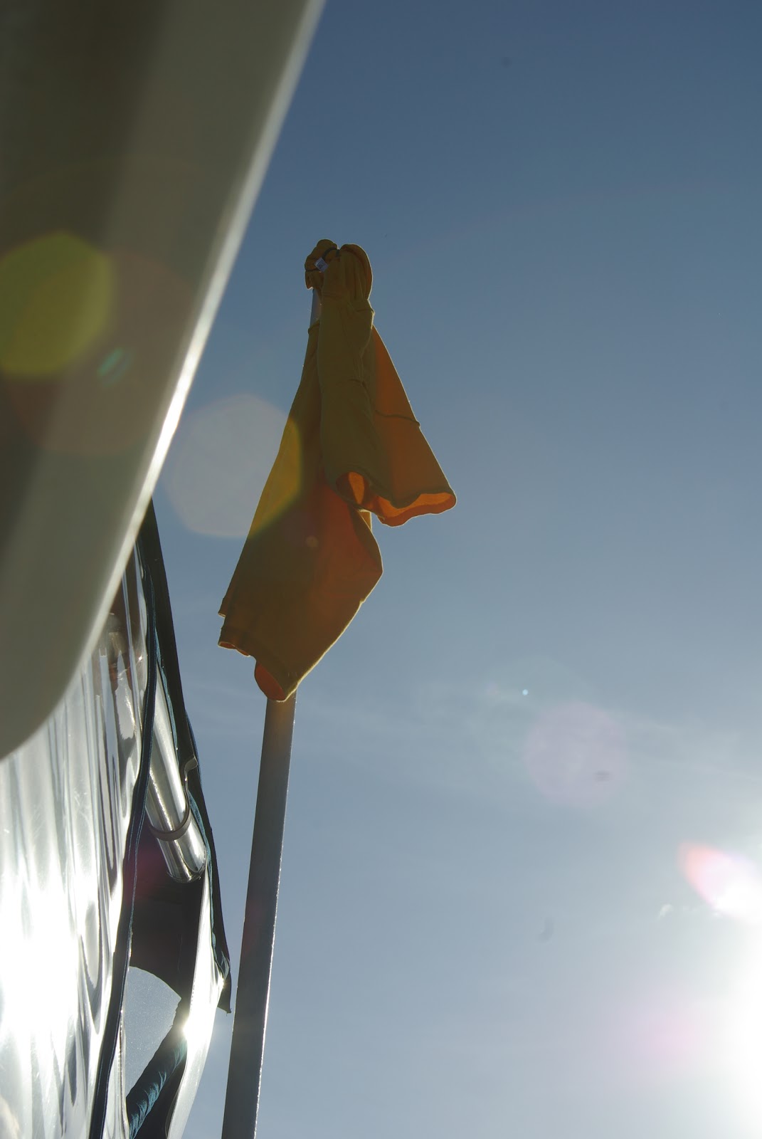
   You must fly a yellow quarantine flag until you check in then you fly the Bahamian Courtesy flag. Tom wanted to save nineteen dollars so he flew his yellow shirt as the yellow flag.
                                                                Entrance to Port Lucaya
                                                    Another view as we entered the harbor

Feb. 15th Crossing to the Bahamas

The alarm went off at four in the morning. Tom looked over and said,well, are we going to do this? I'm ready. Lets go I replied. As the words came out of my mouth I thought,did I really just say that! I would loved to have taken my blood pressure as we pulled out because my breathing was pretty quick and shallow.  Using the spotlight to guide us around the other boats and out to the ICW we were off.  It's funny as I type this from our anchorage in the Bahamas the moon is full, bright and beautiful, lighting up the sky and water. The morning we left for the Bahamas the moon was a sliver and absolutely no help to us!  I had hoped that the lights from the surrounding city would prove helpful. That hope was short lived as we neared the cut through at Port Everglades and the peripheral lights of the city disappeared. Tom was a little concerned that we would encounter a freighter, something I had not given a thought and could have gone without a reminder. Fortunately the only large boat we encountered was a mega yacht that pulled out a ways in front of us. Following his lights out the cut was a nice addition to our chart plotter. We were told that the first three miles would be bumpy but it would calm down to the predicted two to threes after that.  Well bumpy was an understatement. The waves were coming from all different directions and when waves splash over the bow and the spray hits the fly bridge, bumpy is not a word I would use to describe them. Because it was dark you had no idea from which direction the next big one would hit you. It was pretty intense. Tom did a lot of swearing, I fell down twice trying to move from one side of the fly bridge to the other and Peanut was absolutely a mess. I put her up on the bench hoping that would help. She ended up in my lap her head in my armpit shaking like a leaf. To keep from falling again and provide support for Peanut I stayed put.  The beautiful glow from the waters edge, a sign of  the upcoming dawn was a sight for sore eyes, and other parts.  We could finally see the water and adjust our angle to head into waves.  After the sun came up I took over the wheel. I announced "brace yourself" before each of the bigger waves so Tom didn't end up on the floor as I did.  For the very first time ever Peanut crawled up on Toms lap and hid under his arm pit as she had done with me.  About noon the waves subsided to the two to threes so I carefully ventured down to the galley to make lunch. It looked as if someone had come in and ransacked our boat. Anything that was sitting up was now laying on its side or worse on the floor. I have a three tiered hanging basket in the galley that was full of potatoes. The basket was nowhere to be found. I found potatoes on the floor, up in the salon, under the table and even in the sink! Guess I should be glad I wasn't down there to get one in the head! I made lunch which required good balance but didn't bother to pick up anything that fell. After all it would just fall again. By late afternoon the waves subsided to one to twos, the water turned a beautiful emerald green and we could see the bottom even at a depth of twenty feet! Peanut had calmed down and we were enjoying the ride. As we talked about the mornings events and I warned Ton about the mess below he admitted that he almost turned us around, especially when things didn't improve after traveling the three miles. Because the Gulf Stream runs North we were told to run our course ten degrees off because the stream would correct it, keeping us from overshooting our destination.  It was good advise. At 5 pm we were safely tied up at the fuel dock and heading up to the immigration office to check in. Laughter had brought us across safely to the Bahamas! We did it!
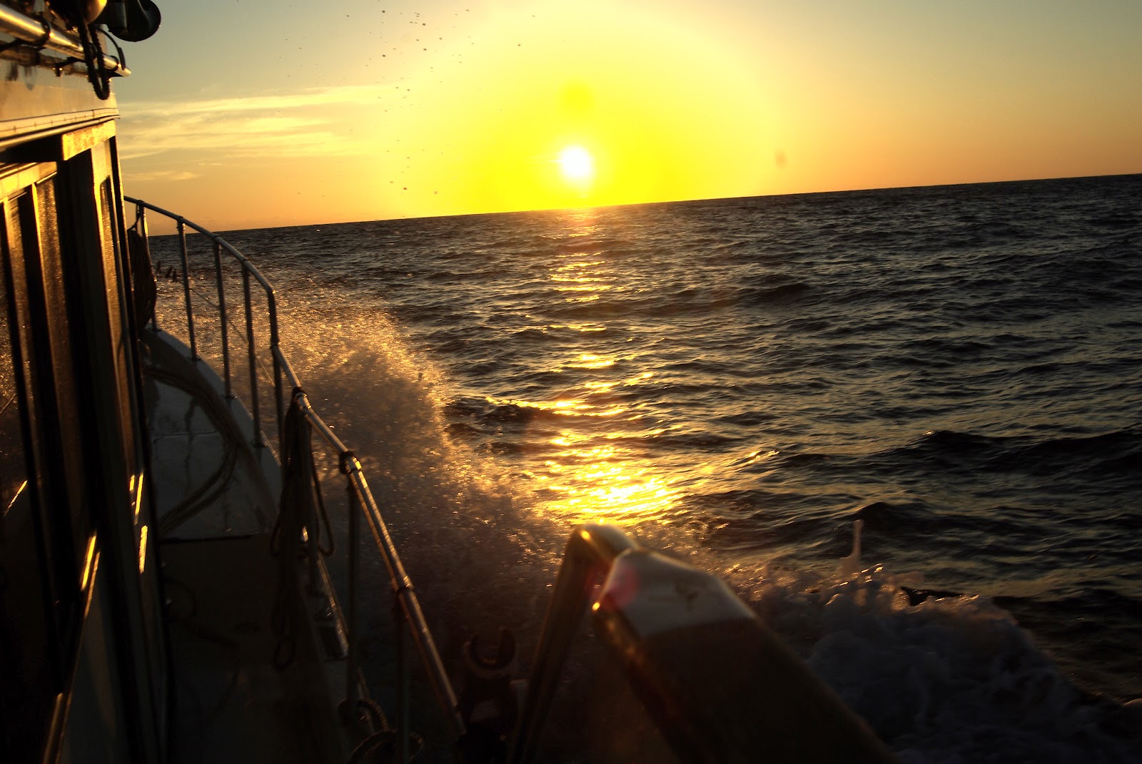
                                    Waves breaking over the bow crossing the Straits of Florida
                                                       Another shot of the waves we battled
Sunrise


Feb. 10-15th Weathered in at Lake Sylvia

The first 2-3 days anchored in Lake Sylvia were fun.  Two canals joined the lake with street levels bridges. It was an easy dingy ride down the canal, across the ICW then down another short canal to a Raw Bar.  The bar allowed you to tie your dingy up to their dock only asking that you eat or drink at their bar in return.  From the Raw Bar it was a nice walk to a local outside mall area. They had the biggest wine/liquor store I had ever been in!  I swear it was the size of a Kroger or Stracks. Great prices too so we stocked up one more time before leaving the states.  One evening we enjoyed dinner with the daughter of a good friend who lives about 45 minutes from our boat. Another evening we enjoyed the company of a couple we had met at the AGLCA  conference in October.  By Sunday the 12th we were beginning to get antsy. It sounded like the next weather window for crossing to the Bahamas would be Wednesday, the 15th but we still had not met anyone who was crossing. We had said all along we would not attempt the crossing alone but now had to reevaluate that decision.  I had even posted a note on the AGLCA blog in hopes of boosting our chances. New boats arrived  throughout the day on Monday, most of them sail. We would routinely take our dingy around, meet the new arrivals and ask their destination. No luck finding a boating buddy but we did meet a very nice couple from Manchester England who winter in Florida and spend their summers sailing in Turkey. Nice huh?! We had a lovely time talking with them and they told us to look them up when we come over to England in September.  Back to the boat, we again sat on the aft deck reviewed weather, charts and talked about what to do.  This time when we looked up to watch another boat come in and anchor we realized we knew them.It was Little Mick.  Excited, Tom hailed them on the radio. Yes, they were crossing with two other boats, yes they were leaving on Wednesday! Whew Hoo! Only one slight problem, they were going to West End. We were going to Port Lucaya. We checked out our charts and confirmed that our paths would be similar for a while so we would at least have visual company for a pretty good distance.  Port Lucaya is about 20 miles further than West End so we were happy to hear that they wanted to leave at 4:30 am. That would assure our arriving in Port Lucaya in the daylight. Little did I know that the calm that I finally felt about the crossing would be short lived.  On Tuesday we had a four way planning conversation via the VHF firm up plans. Little Mick and his friends had decided to wait until 6:30 am to leave! That would put us in Port Lucaya in the dark. So much for company. Now Tom and I had a decision to make. We either change our plans and travel to West End, wait for a few days in hopes of meeting another boat or go on our own to Port Lucaya. Tom was adameant. He did not want to pay the $100.00 dock fee to stay the night at West End and we did not want to wait for the next weather window. sooooooo we were again on our own.  I put the waypoints in the GPS, double checked them and Tom did the engine checks. We set our alarm for 4am. The decision was made!
                               A company making a commercial for jet pack tourist attraction

                                               An interesting bar along the ICW

                                              A mansion and their matching Megayacht
                                             Two megayachts we passed on our dingys each day at Lake Sylvia

Saturday, March 10, 2012

Back at Last - Let's catch up from No Name Harbor to Lake Sylvia

I deeply apologize for the long lapse in posts.  We have had a lack of Internet service, poor Internet service, a week when I flew home etc.  I know, excuses, excuses.  We spent one night in No-Name Harbor. Our next destination and our jumping off point for the Bahamas would be Sylvia Lake.  The weather was still ugly, overcast sky's and very windy. It rained off and on all morning.  The sight of the Miami skyline was another one of those "wows" for us even in the bad weather. We are really traveling down the ICW through Miami Florida on our own boat!  Have you heard the phrase, "size is relative"?  Well when your 42 foot boat is first in line patiently waiting for a bridge to open and two mega yachts approach and pass you just as the bridge opens I guess they figure size does matter!  We found the yachts and boats in general to be a little rude today. They pull out in front of you, pass you at full throttle, and take as much space out of the middle as they choose. I found myself playing a couple games of chicken down the ICW.  The bridges are very close together and only open on the hour and half hour.  We were able to pass under all but two of them.  As we approached one of the last bridges before our destination we knew we had about a foot clearance.  Only inches away from the bridge a bicyclist on the bridge starts yelling NO! NO! stop don't do it!  From his viewpoint he was sure we were going to hit the bridge.  I took a deep breath,( maybe to make us shorter), and under we went. On the other side I waved at the bridge tender and looked for the bicyclist. But he was nowhere to be seen.  Once through the downtown areas of Fort Lauderdale the industrial area was in view. Port Everglades was an extremely busy port and the water was choppy from all of the activity of the cruise ships and freighters.  Just before we reached the point where the ships exit to the Atlantic all traffic was stopped by the water police to allow a large freighter to leave its dock and head out to sea.  Some of us obeyed, others had to be yelled at by the police.  There was a large Carnival Cruise ship docked and we had to pass very close to it.  I stood on the aft deck and waved to the passengers and took some photos but not a sole waved back.  The next day I read in the paper that the ship had to return to port because 300+ passengers and crew became ill on the cruise.  Could be why they didn't smile and wave.  We arrived at Lake Sylvia about 2pm.  It is more like a bay than a lake.  I was a little worried that it would be full of boats waiting to cross but to my surprise there were only about five other boats anchored.  We found a spot with a view of a huge mansion from our aft deck and settled in.
                                                        A view of our apporach to Miami

               
                                                              Miami

                                                          On the ICW through Miami
                 A canal that we went down in Lauderdale to fuel up. Very quaint area

Thursday, February 16, 2012

Tarpin Basin to No Name Harbor

Another gloomy rainy day.  No sign of the sun.  As we crossed a very choppy Biscayne Bay we could barely see Miami in the distance because of the haze. That was a little disapointing but maybe it would clear later. We were excited about getting to No Name Harbor as it is one of the jumping off points to the Bahamas. We were hoping to meet at least one other boat to buddy up with for the crossing.  When we arrived there were two other boats anchored, both sail. We found a spot, anchored then took a very excited dog to shore. It had been two days since Peanut had her paws on land and she could not wait to get there. She and I took a long walk through the state park to the light house and beach a walk we both benefited from.  By early evening the harbor was full of boats. We talked with a few of them but no one was going to the Bahamas.  We decided to dink over to the next little harbor that is also a staging area for the crossing. The entrance to Hurricane Harbor was shallow so we were glad we had not tried to get in there.  Hurricane harbor had one occupant, a sailboat that was going South.  Back on the boat we talked and decided to head further North to Port Everglades in the morning. It was a better jumping off point for our needs and hopefully we would meet someone there.  We did make one more trip to shore after dark in hopes of seeing the city of Miami all lit up. You can guess our disapointment when we found we could not see the city from the edge of the park.
                                            lighthouse at No Name Harbor also nice beach
                                              Miami when the haze improved in the evening
 

Marathon to Tarpon Basin

It's midnight and I should be asleep resting for a long day on the waterway tomorrow  but I find myself sitting on the bow pads enjoying the silence of the night. The water is like glass tonight, the wind nonexistent. A welcome break from the past several days. The night is filled with the twinkle of white anchor lights on the water. An occasional ripple changes the shape of the lights, stretching them like fingers reaching out to beckon a passerby. The red lights of four nearby towers flash adding color to this beautiful painting on the water.

Up and at um early. What a stark difference from the prior evening. Overcast, windy and gloomy.  Storm clouds and rain could be seen out on the Atlantic as we left the harbor. That made me a little nervous. We wanted to run the the Atlantic side up to Penni camp State Park but because of the weather the ICW would be a better route.  The storms seemed to follow us the entire day but luckily never really caught us.  We had showers now and then and wind but no storms. I was thankful for that.  We arrived at Tarpon Basin our anchorage destination about 3:30. I was bringing us in. The charts, chart plotter and depth finder all seemed to agree on the depth. I kept a close eye on the chart plotter while maneuvering but failed to monitor the depth finder. Big mistake. The chart plotter indicated five foot of water when the alarm went off indicating we were in TWO feet of water. We need almost four.  So much for those silent little thoughts that occasionally crept into my head "I won"t touch bottom because I pay very close attention to what I am doing" I was furious with myself and the chart plotter. While we waited to float into deeper water I checked the charts against the chart plotter. Both indicated five to seven feet of water in this area. Ugh!  So much for my clean record. Once back in seven foot of water we anchored and threw a line in before dinner. Tonight a New moon appeared through the clouds. Pretty
                                                         New moon at Tarpon Basin
                                           Skies over seven mile bridge as we left Marathon

                                            The dark skies made the water look really greeen

                                                Not an inviting sky as a backdrop for boating